
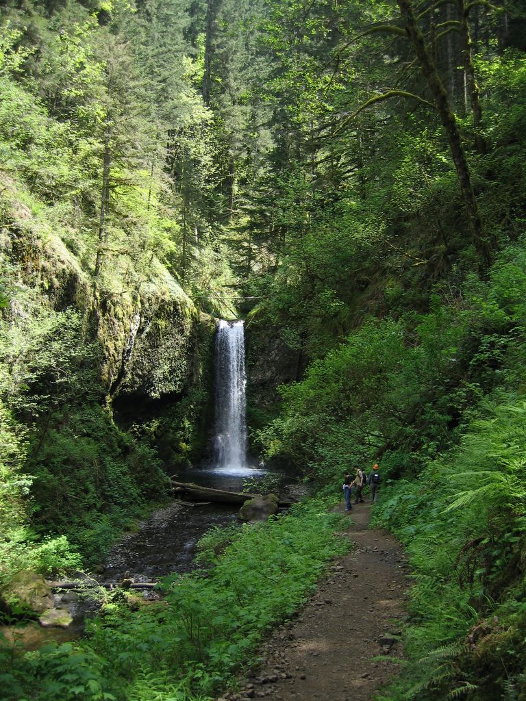


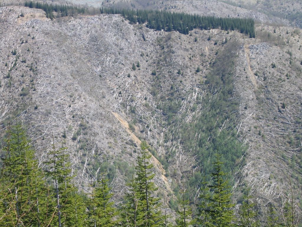

(First three pictures: Wahkeena Creek and Multnomah Creek/Multnomah Falls in the Columbia River Gorge. Last three pictures: Mt. St. Helens National Volcanic Monument.)
What's amazing to me is that these places are just two sides of the same geological coin. The only difference is that one place has had enough time since its last cataclysmic event to let water and wind sculpt it and revegetate it. From the air, you can sense this: other than the lack of vegetation, the area devastated by Mt. St. Helen's 1980 eruption is eerily similar to other parts of the Cascades quite close to large populations. Up close, though, it's a moonscape, an awesome testament to the unbridled power of a volcano that's not quite ready to go to sleep.
Take a look at the last picture of Mt. St. Helens' crater. Do you see the large spine of snowless rock that is steaming? That formation is new since September 2004. It is now 1500' high and continually growing. It's big enough to be seen from the air over 50 miles away. Scientists say that if this new lava dome continued to build at its current rate, the mountain would be back to its pre-1980 height within ten years. That's not even a blip in geological time.
The nearly continuous eruption of Mt. St. Helens over the past two years reminds us that the Juan de Fuca plate is still happily grinding away under the Pacific Plate, the same process that built the Cascades and blew away the north face of Mt. St. Helens. The Pacific Northwest has been rocked by "great earthquakes" (8.0+) every 300-800 years when this fault slips; it has now been 306 years since the Cascadia Earthquake (9.0!). Many other Cascades volcanoes are active; Mt Rainier is the most dangerous of these, as it has a history of sudden collapses which trigger massive lahars (destructive mudflows). Tacoma, Puyallup, and parts of Seattle were built on the remains of past lahars that occured every 500-1000 years with the last big lahar happening around 530 years ago. The mayor of Orting, WA, is actually a customer service agent at my airline; I suspect she lays awake at night pondering the fact that her town of 3760 folks could be destroyed by even moderate lahar activity.
All this makes the Pacific Northwest just that much more interesting of a place to live and fly. When you see the area from the air, the geological events you read about become very real, and not all that distant in the past. Of course, I try not to say any of this on the PA; I don't think the pax would enjoy my VFR tours of the Cascades nearly as much!


2 comments:
I wish the crews of the flights I've taken to SEA would have told us when we flew over MSH. It is so eerie from the air. Great that you could do the hike.
PDX-SEA is such a quick flight in my airplane, we don't have a whole lot of time to be on the PA. Sometimes if it's particularly nice out we'll modify our route to go closer to Mt St Helens and/or Rainier, and then we'll tell the pax about it.
Post a Comment