Wednesday, July 07, 2010

The Long Road Home

Minnesota enjoyed a much warmer, dryer, and earlier spring than normal this year, and by early April motorcycles were emerging in hordes from the garages of their winter dormancy. Every time I saw them out cruising around the lakes on a beautiful evening, I'd feel a little pang of envy. Minnesota's riding season is too short to spend without a bike. It was time to bring the Beemer home.

Two weekends after I left the BMW in a Chelsea storage unit, Dawn and I arrived in Boston during a torrential late-night downpour. Fortunately the hotel van was waiting and we were only minimally soaked in the mad dash across the street. I hoped the cold front would depart as speedily as it came, for we had three days to ride and nearly 1100 miles to cover. Alone, I have dashed out 500-mile-plus days in bitter cold, suffocating heat, and torrential rain - occasionally all in the same day! However, being blessed with the rare gift of a wife who willingly spends her free time on the back of a bouncing, shaking motorcycle and actually enjoys the experience, prudence dictates that I keep her discomfort to a minimum when she accompanies me. That means riding in good weather, taking frequent breaks, and quitting at a reasonable hour.

To my relief, Saturday 15 May dawned with baby-blue skies, light breezes, and rapidly warming temperatures. I walked over to the storage unit alone, got my faithful steed out of hock, and rode back to the hotel. We had but 275 miles to go that day, so we took our time packing and preparing for the ride. However, I failed to look at a local map to find an onramp to US-1 North. Our first twenty minutes of riding were spent going in loops around Chelsea's confusing tangle of one-way streets, dead ends, odd angles, and utter lack of signage. In frustration, I found a side street running fairly north, took it a few miles until the congestion eased, and turned west on the first major cross street I came to. The trick worked; there was a clearly posted onramp to US-1 North. That small victory achieved, I concentrated hard on surviving the ride out of town. The section of US-1 northward out of Boston is too narrow, twisting, and potholed to be considered a true freeway, but everyone drives as though it is. It was a relief to reach the straight, wide-open expanse of I-95.

Forty miles north, we stopped in Portsmouth NH to look for a replacement for my left-hand mirror glass, which had been lost back near Harrisburg PA a few weeks prior. Happily, the local BMW motorcycle dealership had the glass in stock, and we were back on the road in short order. Upon entering Maine, I-95 became a turnpike. I've grown to detest toll roads on this trip - not because of the tolls themselves, but because I've nearly dropped the bike several times after losing my footing on heavily oil-slicked tarmac at toll booths. Having Dawn on the back helps, since she can get the change ready as I ride up to the booth.

Shortly after Portland, we exited I-95 onto US-1 and stopped for lunch at the tiny Brunswick Diner, which appears to have been converted from a rail car in the mid-1940s. The food was excellent. Finding little hole-in-the-wall places like this all around the country has been one of the highlights of this trip. After lunch, we continued northeastwards on US-1. Before this trip, Maine was one of two states I'd never been to (Alaska being the other); I found it very pretty on my first visit, although less wild or remote than I'd imagined. We rejoined the coast at Penobscot Bay, which provided beautiful scenery and picturesque towns to make the time go by quickly. In Rockport, we passed a red K100RS identical to mine going the other way, its rider waving enthusiastically with a huge grin.

We arrived in Bar Harbor shortly after 3PM. On the recommendation of a reader who was once a ranger at Acadia National Park, we continued past town to Blackwoods Campground. In the summer you need reservations well in advance to camp here, but in mid-May it was half-empty despite having beautiful camping weather for the weekend. After making camp and chatting with another rider who stopped by to admire the Beemer, we headed out to ride the ring road around the park. Here, I found the Maine I'd been imagining: wild, craggy coastlines ringed by thick, dark forests. It was beautiful. We only saw a few other people along the way, adding to the desolate feel. I suspected that there was a lot more country like this further up the coast (or "down east" in Maine-speak). New Brunswick was only a few hours away, and from there we could ride to Nova Scotia. Prince Edward Island and even Newfoundland were within reach via ferry. I wished I had more time. I've found in the course of my travels that visiting new places seldom sates my wanderlust but only piques my interest in other places I'd hitherto only thought about in passing. Alas, Bar Harbor would have to be the northeastern terminus of this particular adventure.


After a quiet evening enjoying fresh seafood, local brews, and a walk around the already-shuttered town of Bar Harbor, we turned in early for the night and woke at 6am feeling very refreshed. We wasted no time breaking camp and getting out of town, for we had a long day of riding ahead. Once off Mount Desert Island, we headed north on US-1A to Bangor. I saw signs warning of "Road Reconstruction Next 18 Miles," but wasn't horribly concerned until the pavement abruptly ended and deep, loose gravel began. "Reconstruction" meant exactly that, they tore up the entire road in preparation for resurfacing. After a few miles of slow riding through the rough, pavement would begin again and I'd breath a sigh of relief - only to spy another long stretch of torn-up road around the next bend! It was a long 18 miles.


We bypassed Bangor on I-395 and I-95, but exited the freeway onto US-2 a few miles later. The first hundred miles or so wound through mostly flat farmland, with small towns spaced every few miles. It was nice riding despite the frequently reduced speed limits. At Dixfield the road joined the Androscoggin River and followed it upstream through several paper mill towns into increasingly hilly terrain. At the New Hampshire border the mountains began in earnest, and we soon spied Mount Washington looming to the southwest. At Gorham, we turned south on NH-16, a beautiful road with lovely vistas unfolding around every fast sweeper. We ate a late lunch in Jackson and continued down to Conway, the start of the famed Kancamugus Highway. I'd been wanting to drive the Kancamugus for some time, and went a little out of my way to include it on the route for this trip. It was a bit of a letdown. It was a nice enough road, but not as breathtaking as its reputation would suggest; it's mostly a forest road that crosses one minor pass with relatively few views. I have little room to complain, though, as I've certainly not been wanting for truly spectacular roads throughout this trip.


We continued on NH-112 west of US-93, a road I actually did drive several years ago while in initial training up in Montreal. This road was narrower, snarlier, and wilder than I remembered, with heaving turns and crumbling blacktop making for some wide-awake riding! At the Vermont border, we joined US-302 to Montpelier, another road I'd been on in 2007. It was surprisingly traffic-free for a Sunday afternoon, with one little black Saturn breaking trail for us at a perfectly constant 65 mph around 40 mph-rated turns. Cagers are very useful as cop-bait and deer-catchers so long as they keep up a comfortable pace!

At Montpelier we hopped onto I-89 and hurled westward towards Burlington. It was now late afternoon, and there was a 5PM ferry across Lake Champlain I wanted to catch so we could reach Lake Placid at a reasonable hour. South of Burlington, we seemed to hit every stoplight on US-7. Finally we turned right onto Ferry Road at 4:56PM and scurried down to the landing, hoping the ferry wouldn't be too punctual today. Luckily, it was running about ten minutes late. The ferry crossing itself was a lovely break from our hurried pace. Cloudless skies, mid 70s temps, light breeze, the western sun silhouetting the Adirondacks and glinting off the waves...it was a perfect day to be out on Lake Champlain. We were thoroughly relaxed by the time we landed in New York, our fourth state of the day, and rode the final scenic hour through the mountains to Lake Placid. In all, we rode about 450 miles on Sunday.


I initially missed our turnoff a few miles before Lake Placid, and realized I went too far upon spying the foreboding ski jump complex just south of town. There are surprisingly few campgrounds near Lake Placid; however, the Adirondack Club allows public camping at their Adirondack Loj on Heart Lake. I found the correct road on my second pass. A half-mile south of the highway, the road rapidly deteriorated into a heaving, potholed, gravel-strewn mess. The further we went, the worst it got. It occurred to me that unless there was food available at the Loj, I would be riding this road at least three more times, at least once in the dark. When it seemed like the road could get no worse short of ending outright, we came upon the historic Loj complex. We checked in and set up camp a few feet from beautiful Heart Lake, and it was such a lovely, peaceful spot that it pained me that we couldn't stay longer.


Sure enough, no food at the Loj, so we rode back into Lake Placid as the day's last light turned the High Peaks golden. We rode the length of the town twice, taking in views of Mirror Lake and the town's namesake lake to the north. It was getting dark when we pulled into the Lake Placid Pub & Brewery. It was a shame we weren't staying within walking distance, because I wouldn't have minded a few more pints of their delicious Ubu Ale. With a dark ride down the treacherous road in mind, I cut myself off early. As it turned out, the road wasn't so bad at night, mainly because I couldn't see all the cracks and potholes and gravel. I simply rode over it all at speed and responded to the occasional unexpected jerk, swerve, and slide.


The night in the mountains was chilly and I slept fitfully through the early morning hours. As soon as the sun was up, we were packing to go. We had fewer miles to ride today - about 350 - but had a flight to catch out of Buffalo at 5PM, and I was hoping to even make the earlier 2:30PM flight. We decided to ride for a few hours before stopping for breakfast. We took NY-86 west to Saranac Lake, NY-3 to Tupper Lake, and then NY-30 and NY-28 south towards Utica. The riding was excellent, with smooth roads, sweeping curves, and plenty of lake and mountain views. At the western end of Seventh Lake, we stopped for breakfast at a small tavern called Drake's Inn. The food was fine, but we mostly lingered to eavesdrop on a colorful assembly of wise-cracking local old-timers straight from central casting.

Back on the road, we soon left Adirondack Park and headed south to join I-90 to Buffalo. We needed gas but couldn't find any filling stations at the intersection of NY-8 and the freeway, so we headed into Utica to find one. It took a bit of searching before we found a station, but our wandering in the meantime cemented Utica in my mind as one of the bleakest, most depressing smaller cities I've seen lately. Once the Beemer's 4.4 gallon tank was full, I wasted no time in getting on the Interstate.


I wouldn't have minded taking my time through Erie Canal country, and particularly the Finger Lakes region, but we had a plane to catch so we blasted westward on I-90, only stopping when our rear ends could take no more time in the saddle. Within a few hours, we were exiting at NY-78 and riding the last mile to the Buffalo Airport. Up until now, I've always managed to score free parking for the Beemer between legs, but in Buffalo my luck ran out. We parked in the economy lot, scurried to the terminal, checked in, hurried through security - and arrived at the gate just in time to see the 2:30PM flight to Detroit push back. It wouldn't have mattered, as the flight went out full, and the gate agent informed us that the 5PM and 7PM flights looked equally bleak. Our connecting flights from Detroit to Minneapolis had also filled up in the three days since I'd last checked flight loads. I didn't have to be back to work until Wednesday, but Dawn was supposed to teach the next day and she'd already taken a personal day to be able to do the 3-day weekend with me.

Some creative scanning of the departures board and excellent last-minute cooperation by WidgetCo and United gate agents got us ZED passes onto a 4:30PM flight to Chicago, where we caught a NewCo flight to MSP. I was relieved we made it back but wished I had enough time off to do the entire Boston-Minneapolis leg in one go. Instead, the Beemer would sit outside in Buffalo for a few weeks, and then we'd try to run the nonrev gauntlet back to BUF for the last leg home over Memorial Day Weekend.

To Be Continued....


View 2009-2010 Round Robin in a larger map

Thursday, June 17, 2010

Long Day

Louisville, 1:06 AM. I am lying back in a chair in my cheerfully nondescript hotel room, feeling the adrenaline seep out of my limbs. I've been running at one hundred and ten percent for hours now, and it's almost impossible to go straight from that to sleepfulness, so I sit here trying to decompress. A drink helps. The crew and I were planning on having a nightcap - our show time isn't until late tomorrow - but the hotel bar was closed by the time we finally arrived, and there's nothing else open nearby. Instead, I pour myself a short glass of scotch from my own flask. The ice crackles and tinkles softly, accentuating the silence of my room. I take a sip and think back on the long day.

I woke up at 6:30am and set about the familiar routine of preparing for a morning show: showering, grooming, ironing, dressing, making my lunches, packing my overnight bag - always in the same order, lest I forget something. Alas, I did forget my cell phone charger, so I will be raiding the hotel's lost and found tomorrow. Dawn gave me a ride to the airport before her 9am doctor's appointment, so I arrived quite early for my 9:20 show. This was my first time back to work since NewCo switched to a completely new, electronic system for weight & balance and takeoff & landing performance calculations to replace our tried-and-true manual method using paper, long addition, and a whiz wheel. I intended to use the extra time to get to the airplane early and see if the system really worked the way our training materials said it would, but I ran into some old friends in the crew room, talked for longer than I realized, and ended up having to hustle to make it to the plane by our scheduled show time. I chatted with the gate agent a little, checked the radar and upper air charts on his computer, collected our paperwork, and walked down the jet bridge to meet my crew. The only one I'd flown with before was Linda, a retired schoolteacher whose former profession obviously endowed her with the patience that makes her an exceptional flight attendant. Our other flight attendant, Trisha, is brand new, having just come off of OE. Our FO, Kevin, is a middle-aged family man who spent ten years at Air Wisconsin and finally made the jump to United two years ago, only to be furloughed a day before completing his initial training. Rounding out our quintet for this leg was Steve, a friendly United captain I last gave a ride to O'Hare only a few weeks ago. The flight was full, and he would again be sitting in the flight deck jumpseat.

Our day got off to a late start thanks to cleaners who neglected to show up for the first hour of a 90-minute turn, subsequent late boarding, passenger-counting difficulties, and some grappling with the new W&B system on my and Kevin's part. We pushed ten minutes late, then got a last-minute taxi change to the far runway. Within a few minutes, though, we were whistling down 30R, rearing into the air at 141 knots, and turning southeastward towards Chicago shortly thereafter.

While Chicago-Midway was one of our very first destinations, my company only began flying to O'Hare a few months ago. It has quickly become one of the mainstays of our trips. I originally approached O'Hare with some trepidation, given its reputation for heavy traffic, a complex layout, and no-nonsense controllers. I quickly discovered that O'Hare, like all big, busy airports, has a well-developed, predictable flow to its operations, and is actually pretty easy to fly out of once you learn the logic. The one thing I haven't figured out yet is how they assign departure runways; there are occasionally up to five in use, and which one you are assigned seems to have little relationship to your position on the airport or your direction of flight. Even this lack of predictability is handled easily enough: you brief all the possible runways and taxi routes, get takeoff performance for every possibility, and taxi out on both engines. That leaves less to do when you are inevitably switched to an inexplicable runway choice. Nothing seems to please O'Hare controllers more than a crew that's ready to roll at a moment's notice.

The one thing we did today that I hadn't yet experienced was landing on the "new" runway, 27R. It is a good two miles north of the main complex, making for a long, circuitous taxi to the terminals. Fortunately, it's only used during peak periods, which today at 11 AM definitely was. The taxi instructions to our gate were a little bewildering: "Charlie One, Charlie, Uniform, Echo, Zulu, hold short of Tango, monitor ground one three two point seven" then "Tango, Whiskey, hold short 4 Left", then "Cross 4 Left, Echo, Bravo, Alpha Ten to the gate". Go ahead, try to trace it on the airport diagram. Now try to figure it out while taxiing a plane and stealing only occasional glances at the chart (the cardinal rule of ORD is "Don't Ever Stop"). Having a sharp, experienced FO who was once based at O'Hare helps a lot!

Our ops people turned the full plane surprisingly quickly, Kevin and I again flubbed the weight and balance calculation on our first try, and we again pushed around ten minutes late. For once, I correctly guessed our taxi route and departure runway: A, A7, T, 32R at T10. We nibbled at a United Airbus' wake turbulence on takeoff - they weren't even off the runway when tower cleared us to roll - but quickly got upwind of it as we turned snappily to our assigned 360 heading. Soon we were arcing out over Lake Michigan, weaving around afternoon buildups before picking up the Muskegon transition to Detroit's Polar Three Arrival.

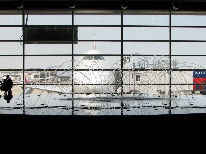
I really enjoy flying into Detroit. It's a fairly busy airport, but a well-laid out one, and operations generally flow freely and predictably. The McNamara Terminal still gleams and echoes with the songs of birds who have flitted inside, and the sight of a 747 behind the dancing water fountain has already become an iconic image of aviation. The only downside, for me, is that the airport's taxiways look and feel more bombed out than Beirut circa 1982. Fortunately, the airport has undergone a steady program of resurfacing over the last few years. This time, taxiway Foxtrot just north of NewCo's northeast gates was ripped up. To provide an alternate route to our gates, A75 through A77 have been taken out of service so aircraft can use the ramp to transition from Uniform to Uniform Eight. The system seems to be working pretty well.

We had a three hour "productivity break" in Detroit, even after our late arrival. NewCo has a crew base there, but Minneapolis crews can't normally access the crew room as it is located in an area accessible only to holders of Detroit SIDA badges. Fortunately for us, Kevin had been based in Detroit for a month and had exactly such a badge so he could escort us to the crew room. I spent my break trying to figure out a way to get my little brother Steve and his girlfriend Torrie home from Hawaii. They'd flown to Honolulu on my buddy passes over Memorial Day weekend, lured by the promise of wide-open flights coming and going, only to find themselves on the bottom of an 80+ person standby list for every flight they tried to take out. After talking to a family of five that had been trying to get out of Honolulu on buddy passes for nearly two weeks, Steve decided to bite the bullet and buy positive-space tickets back to Minneapolis. The price was surprisingly cheap for a same-day one-way ticket: $585. Once again, Honolulu confirms that its reputation as a non-rev black hole is well-deserved.

Our plane arrived only 25 minutes before our departure to Charlotte, so our third consecutive leg blocked out about ten minutes late. Every seat was once again full, and we were also carrying quite a bit of extra fuel in anticipation of possible thunderstorms developing near Charlotte. The northern portion of the route featured typical late-afternoon buildups that were still well below our cruise altitude, but as we crossed into Tennessee we started spying 45,000 foot giants further ahead. I pulled up the ATIS at Charlotte: "3/4SM +TSRA". We wouldn't be landing in that. I texted our dispatcher to inquire about what she was seeing on radar, and she promptly replied that the thunderstorm was relatively small, but parked directly over the airport with very little movement. She also changed our alternate from Raleigh-Durham to Knoxville due to another thunderstorm developing just west of RDU. I love getting one of the good dispatchers.

Shortly thereafter, Atlanta Center changed our transition for the JOHNS2 arrival and cleared us to hold at BURLS. No surprise here. I entered the hold in the FMS, verified it with Kevin, and activated it. Kevin started slowing early to save some gas, and I began calculating our bingo fuel. Generally, I compute two "Bingo" numbers when holding for thunderstorms at the destination. The first number is traditional bingo fuel, meaning that required to proceed from the hold to the airport, shoot an approach, go missed, proceed to the alternate airport, and have a 45 minute reserve remaining. If the airport is still questionable when we leave the hold, I won't proceed with less than this traditional bingo number. On the other hand, the weather may clear very quickly after the passage of a storm. If the weather is good and there is no question of being able to land, I am willing to proceed from the hold with less fuel than the traditional bingo number so long as I will land with a conservative reserve. In no case, however, will I hold beyond the time at which I have enough fuel to proceed from the hold straight to the alternate and still have a reasonable reserve on landing. I call this my "drop dead bingo" - once the fuel tanks indicate this number, I'm headed for my alternate no matter how quickly ATC says they'll be getting me out of the hold. The spread between the two numbers can be significant, particularly when holding at a point between my destination and alternate airports. This was now the case.

I texted our holding point, altitude, expect further clearance time (EFC), and fuel on board to our dispatcher. Her reply a few minutes later included a bingo fuel number very close to what I had computed for my traditional bingo. We had approximately 45 minutes of holding fuel above that number. If further holding was necessary, my "drop dead bingo" number was over 1500 lbs less, and our proximity to Knoxville would allow me to either coordinate our diversion in a leisurely fashion or arrange for the deletion of our alternate if the weather in Charlotte had improved sufficiently. As we entered the hold over BLISS, I composed a short PA in my mind and then pressed the "transmit" button to deliver the bad news to our passengers.

As it turned out, the news wasn't all bad. Thirty minutes after we entered the hold, Charlotte began accepting arrivals again. We had initially held at FL330 but had been descended as aircraft below us diverted to their alternates. Only ten minutes after Charlotte reopened, we were cleared out of the hold and back on the arrival; a last minute clearance to cross SHINE at 11000' required a steep, nearly full-spoiler descent. As nice as the JungleBus' Vertical Navigation (VNAV) capability is, it can bite you on such late descent clearances. By the time you actually get your crossing limit set up in the box, you may be too high to make it. For this reason, I apply the tried-and-true "3-to-1" litmus test to any crossing clearance before anyone messes around with VNAV. This is a simple method of computing a 3 degree descent: You take the altitude to be lost in tens of thousands of feet, and multiply it by three to get the distance required in nautical miles. If you need to lose 10,000 feet, you need 30 miles for a 3 degree descent. If my quick-and-dirty computation shows a 3 degree or steeper angle required, I will establish the aircraft in a 2500 foot-per-minute descent (or direct the pilot flying to do so) before setting up VNAV. Technology can make life on the line easier, but Rule One is still and always will be: "Fly the Airplane!"

Lightning crackled just to the east over downtown Charlotte as we landed on Runway 18R. This would have been a full, eventful day even if we were done in Charlotte, but we still had two legs left and were now a full hour behind schedule. At least we were keeping the airplane to Atlanta, making for an easy quick turn - or so I thought! When I followed the last of our passengers up the jet bridge to retrieve our paperwork, I found the gate in a state of bedlam, with a long line of harried travelers querying a lone, distressed gate agent. The board behind him advertised a delayed Minneapolis flight, with a departure time well in the past. "Umm, isn't this airplane going to Atlanta?" I asked.

"I don't know anything about that!" the gate agent exclaimed. "Nothing's going to Atlanta. This airplane is going to Minneapolis, but the crew already timed out. Can't you fly it?" Immediately, a half-dozen passengers surrounded me, imploring me to fly them to Minneapolis. "Hold on a sec, folks, I'm going to call our dispatch office and see if that's what they want us to do." I very much doubted that dispatch wanted us to fly to Minneapolis, or our phones would've been ringing off the proverbial hook already; I mostly wanted to know what in tarnation was going on. I walked down the concourse - out of earshot of the passengers - and called dispatch. No answer. I tried a few other desks. Same results. A glance at a national radar display on one of the flight information boards suggested why: a bright red blob was sitting squarely over Atlanta. It's always toughest to get ahold of SOC during Irregular Operations. I just might have to get answers for myself. I walked up to another WidgetCo gate, this one advertising a seriously overdue departure to Atlanta. "Where is 5750 to Atlanta going out of?" I asked. The gate agent pulled up the flight; "It's going out of A7, and the plane is actually already here. It landed almost a half-hour ago!" I chuckled at that. "Well, that's our plane, and you might want to get the agent down at A7 on the same page, because he thinks he's keeping that plane for Minneapolis!"

The change had been announced by the time I walked back over to A7. Now the Minneapolis passengers were upset at their lack of an airplane as well as a crew, newly arrived Atlanta passengers were utterly confused that the gate was still advertising Minneapolis, and that poor lone gate agent tried mightily to be polite in the face of an onslaught of questions and accusations even as he struggled to switch the computer system from the MSP flight to ours. I stood by the gate and fielded as many questions as I could. Many simply wanted to know if Atlanta was open yet, a very good question I was wondering about myself. I still couldn't raise dispatch on the phone. Again, taking the self-sufficient tack seemed best. I retreated down the jetbridge to fill in my bewildered crew on developments thus far, and to call Clearance Delivery regarding our flow time to Atlanta. Clearance confirmed that Atlanta was opening, but our EDCT time was approximately 70 minutes hence and subject to further change. This was better than I was expecting. I headed back up the jetbridge to tell the gate agent that we could start boarding in 20 minutes; I usually plan on getting out to the runway about 15 minutes before any EDCT time so that unforeseen delays don't cause us to miss our slot.

Our EDCT ended up changing three times before we got out. First it was moved back by 90 minutes, then to only twenty-two minutes from the time I got the change. This might have been doable if we had the passengers on board, but a recent arbitrary and capricious rule change by unelected bureaucrats at the Department of Transportation has made us all a little gun-shy about early boarding. This is a lengthy subject meriting its own post, but suffice it to say that nobody wants to be the Captain who keeps his passengers on board for more than three hours between boarding and takeoff and accidentally subjects his airline to a draconian fine (over $2 million in the case of a full JungleBus, or more than one of our engines costs!). Obviously, twenty-two minutes wasn't enough time to board 76 passengers, run our numbers, and taxi out to the runway. Fortunately our final EDCT change was for only fifteen minutes later. A last-minute runway change resulted in taxiing the long way around a dark, unfamiliar ramp while Kevin grappled with the new takeoff performance system. We completed the Before Takeoff Checklist just as Charlotte Tower cleared us for takeoff on 18L, and I taxied onto the runway very slowly so we could take a moment to compose ourselves and double-check our work before hurtling down a darkened, rain-slicked runway at 160 mph.

Soon after we turned right onto the departure, lightning began flickering off to the east. I knew the thunderstorms that closed Atlanta were moving northeast, or roughly onto our arrival route. I have a certain fascination with thunderstorms, but prefer to observe from the ground; this is doubly true at night. Of course we have radar, but the best means of avoidance is the 'ole "Mark 2 Eyeball," and it doesn't work so well on dark nights when lightning appears to fill the sky and you can't see developing buildups. I turned the instrument lights down low and sat forward on my haunches, peering out into the blackness. South of Spartanburg at FL300, we stumbled upon a towering behemoth that materialized out of the ether like an iceburg in the foggy North Atlantic. We turned thirty degrees right without waiting for Atlanta Center's belated approval. There was no lightning and no precipitation to register on our radar, but I don't doubt this pubescent thunderstorm would have given us a ride to remember had we blundered into it. Further along the arrival, the giant cell that closed Atlanta for hours slid by twenty miles to our right, spitting out lightning menacingly the whole time. I wondered what our passengers thought about it.

We were vectored onto the final for Runway 26R surprisingly quickly and I took advantage of the wet runway to make an admirably soft touchdown. Our seventy-six passengers scampered off the airplane in record time in hopes of making their connecting flights. I stifled a yawn as I collected our paperwork at the gate and checked the radar. I'd now been awake for over sixteen hours and on duty for thirteen. Legally, I could be on duty for another three hours! Over a year after the FAA promised to have new duty and rest time regulations in place and the industry publicly promised to support changes in an effort to contain the media fallout from Colgan 3407, the airlines have been successful in fighting a rear-guard delaying action at the Office of Management and Budget. In the meantime, those of us at the pointy end of things do what we've always done (with varying degrees of effectiveness): decide whether we're safe to fly at the time when we're rendered least capable to make an objective judgment. This time I felt fairly alert - but was it just the fatigue talking?

We quickly loaded up, pushed back, and taxied down to 26L for our fifth takeoff of the day. The lights of the terminals flashing by my window seemed to put me in a momentary trance; a gentle prompt from Kevin snapped me back to reality, and I belatedly commanded "Positive Rate, Gear Up." Perhaps I was a little less alert than I previously believed. The route up to Louisville was blessedly clear of thunderstorms; however, that left less to do, and several times I found myself jerking my head up with a start after nodding off into a micro-sleep. Not good. One of my least favorite memories as a pilot is waking up at the controls of a Navajo on a half-mile final to Burbank and not being able to remember the previous half-hour. Having a First Officer on board makes that scenario potentially less dangerous to life and limb but even more hazardous to career and reputation. I put on the oxygen mask on in the descent to get a few puffs of 100% O2, then turned the autopilot off early. I was expecting a straight in approach at Louisville, but I had forgot that our late arrival would put us squarely in the middle of the UPS rush. It was the busiest I've ever seen Louisville. Approach Control made us fly all the way to IIU VOR, then south for twenty miles before turning in to a twenty-five mile final. At long last, we touched down on Runway 35R and made the short taxi to the gate. The passengers seemed to take forever to file sleepily off the airplane. We were hard on their heels.

After all that, one would think I should be able to go to sleep quickly and soundly. Yet the day somehow feels incomplete. Delivering nearly 400 souls safely to their destinations over five legs and 2000 miles through some of the world's busiest airspace and around its wildest weather feels like a real accomplishment, even if it's done on a thoroughly routine basis. I still occasionally feel myself in complete awe that man can fly at all, much less do so with a high degree of comfort, safety, and reliability in a pressurized aluminum tube hurtling through the outer reaches of the atmosphere. Whatever my opinions on the state of my industry and profession, I still feel extraordinarily privileged to be part of the brotherhood of the air, never more so than after a long, tiring day of duty performed well. I permit myself the small celebration of my glass of single-malt, and then turn in for the night.

Tuesday, June 01, 2010

Appalachian Trail (Part 3)

Our first night of camping was relatively warm (ie 35 degrees) compared to what I endured on my way across the southern states this winter, and I had finally brought along a mummy bag. Brad had a lighter bag but stayed warm by discovering a new motorcycle camping technique: sleeping with his helmet on. We broke camp in record time - I didn't know Brad could move that fast in the morning! - and rode to a nearby Burger King to warm up with coffee, charge our bluetooth intercom systems, and talk about our route. This was our fourth day of riding, and we weren't even done with the Blue Ridge Parkway. Brad needed to get home to Portland by Sunday night, preferably sooner, and the flights out of Boston were full on Sunday. There was an open direct flight on Saturday afternoon, however, and he voiced a hope of making that flight. There was little chance we could complete the original route through northern New England and still make it to Boston in time. We agreed to see how far into northeastern Pennsylvania we could ride today and then decide on our arrival date in Boston and the route to take there. I was hoping that if we got far enough, we might yet be able to put in two long days of riding through New England for a late Saturday arrival.

The sun was warming the morning considerably as we rode the winding road to the Parkway up the Blue Ridge. Upon pulling onto the Parkway, Brad couldn't resist the urge to pass me up and let the beast loose, pulling up into a screaming wheelie right past a couple of park rangers. I meekly followed at 45 mph, avoiding the rangers' steely looks. The last fifty miles of the Parkway were exceptionally pleasant, winding along the top of the ridge for most of the duration, and we reached the end all too soon. We rode directly onto Skyline Drive, a 105 mile ride which is very similar to the BRP except that it lies within Shenandoah National Park, so you pay $10 to enter and the road is posted at 35 mph for its entirety. I can't say we were entirely observant of the speed limit, but we did back off considerably from our Parkway pace in light of the many deer we saw along Skyline Drive. Our northern progress was now noticeable, for many of the trees at higher elevations were still bare. The last five miles of the road from the ridge top to Front Royal were like a time-lapse video of the progression of the season as we descended precipitously through increasingly lush foliage.


The vast majority of our miles since Chattanooga had been through sparsely populated areas, or skirting around cities on the BRP. Riding out of Front Royal on US-340 toward Frederick, the reappearance of heavy traffic and roadside congestion was a little jarring. We passed through the West Virginia, Maryland, and Pennsylvania borders in quick succession, and Brad pulled over to take photos at each "Welcome to..." sign, as is his custom. The steady train of 18-wheelers screaming by without budging from their position in the right lane made me more than a little uneasy. I had selected this route over Interstate 81 mainly because I had expected it to be a quiet, rural stretch of highway; this was our first encounter with Northeastern "suburban sprawl."

We reached Gettysburg by 3pm. Brad and I had agreed before the start of the trip that a stop at the Gettysburg battlefield was mandatory, and my visit to Chickamauga had further stirred my interest. Now, with five hours of light remaining and again falling well short of the mileage I'd hoped to ride today, I considered skipping it. The reality, though, was that there wasn't much chance of getting to northern New England on this leg no matter what I did, so we might as well make the most of the places we did ride to. We spent about two hours riding around the battlefield and stopping at the Gettysburg National Cemetery, site of Lincoln's famous address. The battlefield was recreated in the 1880s and 90s by veterans of the battle, and has since been painstakingly preserved by the National Park Service; it retains many of the original buildings, most of the original network of roads, fields, and fences, and a similar layout of forested areas as in 1863. Looking out across the open fields, it is easy to understand why this was the bloodiest battle of the Civil War: there was simply nothing out there to stop cannon and rifle fire but the bodies of the desperately charging men.


We were back on the road around 5pm, and initially made good time northbound on US-15, a four-lane divided highway. A strong westerly wind had come up, and we were now riding permanently leaned over, weaving occasionally in the gusts. Twenty miles down the road, I hit a small bump and my left mirror glass came out of its housing and tumbled to the roadway. I looked back in time to see it shattering; no point to stopping now. This was the second time it happened on this trip; the mirror is a poor design with the glass held in by friction, and it occasionally vibrates loose on bumpy roads. My aggravation over the loss of the mirror was increased by heavy congestion into Harrisburg, and then construction and clueless drivers on the roads bypassing it. Finally the traffic on I-81 eased and we were able to knock off a final 80 mile run in an hour. It was very clear to me by now that we'd come up well short of the mileage needed to consider making a go at the New England route, so I figured we may as well stop with an hour or so of light left so we could find a nice spot to camp.

We pulled off the Interstate at Hazleton and I used my Palm to search for campgrounds. The only one nearby was the private Sandy Valley Campground fifteen miles away, just outside the run-down hamlet of Freeland. A sign at the city limits declared Freeland to be the "highest borough in Pennsylvania" - just our luck, we'd been hoping for a warmer night! The campground was pretty interesting - from the road, it appeared as though somebody had simply created a campground from five acres in their backyard. We turned out to be the only ones staying the night, although most of the campsites had RVs semi-permanently parked in them for the summer. The rough, loose gravel-covered roads down the hill to our campsite were a challenge to negotiate on the bikes, particularly later that night. The lakeside campsite itself was very nice, with soft flat ground to pitch our tents on.


After making camp, we road back into Freeland to find a place to eat and have a few brews. We selected "The Other Side," the diveyest-looking bar in a divey-looking town. It was packed. We found two open stools, ordered some wings and beer, and talked over our plans for the next day. Brad was pretty set on making the Saturday afternoon flight; he was needed on the home front. Once we got to Boston, Brad was hoping to sell his bike, and if that didn't happen we needed to at least wash them and find some storage on Saturday morning, meaning we should ride to Boston on Friday, the very next day. I had accepted the fact that we wouldn't be able to do New England on this leg; I would simply go back to my original plan of doing it on the last leg from Boston to Minneapolis. In this case, however, we could go through the Catskills on our way to Boston tomorrow, cross the Hudson at Poughkeepsie, wind our way through Connecticut to New Haven, and pick our way up the coast from there for a little over 400 miles of riding. Armed with a plan for the next day, we rode back to the campground and built a campfire to sit around for a few hours, talking and drinking the last of our beer.


The next morning was chilly but we started riding quite early nonetheless. We hopped onto I-81 for forty miles to Scranton - yes, "The Office" theme song was playing in my head - and stopped to fuel up. I reached for wallet and was surprised to find my debit card missing. I thought back and realized that I had given it to the bartender at The Other Side to start a tab, but had then paid in cash without remembering to ask for my card back. I called my bank to cancel the card, and used my remaining cash and backup credit card for the rest of the trip.

The ride through the Pennsylvania countryside northeast of Scranton was a pleasant surprise. Up until now most of our riding in Pennsylvania had been on the Interstate, the rocky hills were starkly nude as the trees were still budding, and the few towns we saw all appeared to be severely down at the heels, brutally industrial, or both. It hadn't left the most positive impression on me. In the northeastern corner of the state, however, we took minor state highways for sixty miles and were rewarded with great roads, beautifully rolling landscapes, and a steady parade of stately picket-fenced farmhouses, picturesque red barns, fieldstone fences, and whitewashed old churches. Crossing the Delaware River at Hancock, NY, the rolling Pocanos gave way to the rockier Catskills. A few miles down the road, we turned northeast on NY-30, which follows the East Branch of the Delaware river, and then southeast on NY-28 to Kingston. This is a beautiful stretch to cruise on a motorcycle, not least for the 55 mph speed limit through many tight sweepers. The only downer was the swarms of insects we rode through. A few were big enough to render me temporarily blinded by loud, messy, green and yellow explosions on my face shield; wiping it off with my glove allowed for occasional glimpses of the road through the smeared bug juice. After the ride through the Catskills, the Beemer was in desperate need of a wash.


From Kingston, we rode along the Hudson River for a short stretch of US-9W. I can certainly see why the Hudson is nicknamed "America's Rhine River," for its resemblance to the section of the Rhine between Mainz and Köln is uncanny. We crossed the river at Poughkeepsie and stopped for lunch at a pizza parlor shortly thereafter. The proprietor took a keen interest in our trip, and talked rather wistfully about how he used to jump on his bike and ride cross-country for days on a whim. Back on NY-55 eastbound, we kept waiting for the congestion around Poughkeepsie to ease, but it never really did. I'd expected the area along the Connecticut border to be rather rural, but it was unrelentingly suburban and the going was slow on NY-55 and NY-22. We jumped on I-84 and raced across the state line, thrilled to be going faster than 40 mph and with no stoplights. Twenty miles later we exited onto CT-34, which on the map looked like a fun road along the Housatonic River but was in fact choked with heavy traffic through endless development. Now I recalled flying from Memphis to Boston at night and seeing the bright river of light of the BosWash corridor; why had I expected Connecticut to be anything other than one big suburb?

It was late in the afternoon when Brad and I finally spied the Atlantic Ocean from I-95 through New Haven. We had been planning on jumping off the freeway to ride along the coastline, but it was now clear that these miles would be long and frustrating, with a late-night arrival to Boston inevitable. No, best to stick to the interstate, we agreed when we stopped to fill up for gas in Madison Center. Despite being rush hour, I-95 was moving freely and we were able to make one final, speedy push of 135 miles through Rhode Island and into Boston as the sun sank into the western horizon. It was nearly 8pm by the time we pulled into the parking lot of NewCo's crew hotel. We had made it, 5 days and 1600 miles since setting out from Atlanta.


The next morning we slept in rather late, had a leisurely breakfast, then took the bikes to a self-service car wash and scrubbed the dirt and bugs off of them. The Beemer hadn't gleamed this brightly since setting out from Minneapolis last July. Brad had a few people reply to the craigslist ad he'd posted a few days earlier, but nobody came to see the FZ-1 on Saturday afternoon; he ended up flying back to sell it for a tidy profit two weekends later. We found a self-storage place a few blocks from the crew hotel with a "first month free" promotion, which was perfect since we'd only need it for two or three weeks. After putting the bikes to bed we caught the hotel van to the airport, went through security, had one last celebratory brew at the Harpoon Tap Room, and parted ways as Brad boarded his flight to Portland. Any lingering disappointment over cutting the trip short was overshadowed by gratefulness that we had finally been able to do a big ride together, we had a great time, and we made it to the end safely. As I boarded the Airbus to Minneapolis, I knew I'd be returning within a few weeks for the spectacular ride through New England and into the Great Lakes states. Better yet, next time I'd be accompanied by my very favorite riding partner.

Monday, May 24, 2010

Appalachian Trail (Part 2)

The sun woke me up before my alarm clock on Wednesday morning; the sky was cloudless and deceptively warm looking, making for a breathtaking surprise when I stepped outside. Asheville was under a freeze warning until mid-morning, which surely meant the Parkway would be treacherous until around noon. We had plenty of time for breakfast, so before Daphne left for work at the Sunny Point Cafe she suggested that we come by. It was a special morning at the Cafe: Good Morning America was filming there for their "Best Breakfast in America" feature, of which Sunny Point was one of the four finalists. When we swung the bikes into their lot at 9am, there was a long and enthusiastic line of diners, but we were seated and served surprisingly quickly. Both Brad and I tried the dish which earned Sunny Point the "Best Breakfast" nomination, Huevos Rancheros with black bean cakes, chorizo, and tortilla chips. It certainly got my vote. The film crew actually filmed Brad and I being served our plates, but when the segment aired on May 15 we were nowhere to be seen. Apparently two wild-haired, scruffy-bearded bikers straight off the road weren't quite what the producer was looking for!


After we said our goodbyes to Daphne and the crew at Sunny Point, we rode to a nearby auto parts store so Brad could change his oil. He didn't know when it had last been changed, as he had bought the bike specifically for the trip a few weeks prior in Nashville. This store didn't have an oil pan we could borrow, but a discarded windshield washer fluid bottle with the top cut off worked nicely and we were on the road a half hour later.


As soon as we got on the Parkway, it was obvious that we had made the right decision in stopping early the previous day. The downwind side of every exposed tree branch was coated with a half-inch of rime ice. We stopped at an overlook to take pictures when the wind began flaking the ice off the trees, creating the effect of snow despite the blue skies. Brad pointed out a group of Harleys with Minnesota plates, so I went over to talk to the riders. They asked where I was coming from, so I launched into the by-now familiar catalogue of places I'd been and roads I'd ridden over almost 11,000 miles. "Which way did you come?" I asked my fellow Minnesotans. They sheepishly admitted they had trailered their bikes the whole way and had ridden 25 miles so far.


The first forty miles of Parkway followed the ridge at between 4000 and 5000 feet elevation, and there was still ice in the shadows; we rode more carefully than we might have on the undulating sweepers. We had just started to descent to lower, warmer altitudes when we came across a "Road Closed Ahead" sign. The Minnesotan Harley riders were stopped at the closure, discussing their options for bypassing the areas of the Parkway closed by the prior day's rains. After talking to them, Brad and I decided on taking NC-80 to US-19E to NC-226, rejoining the Parkway to Linville Falls, and then bypassing it on US-221 until Linville. From here, the Parkway was open to its terminus at Waynesboro, Virginia.

North of Blowing Rock, the Parkway descended into rolling woodland, yet the still-curvy road was no less enjoyable for the scarcity of overlooks. We'd been exceeding the ridiculously low speed limit all day, but now our tempo crept steadily upward into freeway territory. Neither of us said anything about it at the time, but both of us were thinking the same thing: what if a deer jumps out? What if there's stopped traffic around one of these blind curves? In light of events later that day, we talked about this as we drifted off to sleep in our tents that night. It struck me that we, two airline pilots, were both thinking in terms of risk mitigation, yet neither of us was really inclined to slow down.


Along the North Carolina / Virginia border, we rode through at least twenty miles of heavily storm-damaged forest, and crossed at least two narrow swaths of utter destruction that were the unmistakable work of tornadoes. I asked about it at a gas station down the road in Meadows of Dan, VA, and the clerk said the storm came through nearly a year ago. The terrain continued to descend and the countryside became more populous as we approached Roanoke, which the Parkway skirts to the east. We stopped at an overlook around mile marker 105 to call the wives, eat a cereal bar, and decide how much further we wanted to go. At this point it was after 5pm and we had ridden nearly 300 miles since Asheville. I had hoped to reach the end of the Parkway that day but the late start meant we would come up about 50 miles short. I slowly rose off the soft grass where I'd been basking in the late-afternoon sun and climbed back on the bike for one last fifty-mile push.

Shortly after we got back on the Parkway, it climbed dramatically to nearly 4000 ft elevation and followed the top of the Blue Ridge for over twenty miles. The road meandered through strands of birch and poplar trees that occasionally gave way to open sections with vertiginous views of the countryside below. This stretch of Parkway was on par with the most spectacular sections we had seen just out of Asheville earlier in the day. Again our speed crept steadily upward in the absence of traffic or sharp curves. I was getting hungry and was eager to reach Buena Vista, our destination for the night. Twenty-five miles away, the road left the ridge top and started dropping down the eastern flank in its way to the James River crossing, the entire Parkway's lowest elevation. The blacktop became curvier as it followed the terrain, but the first few turns were sweepers and I barely slowed going into them, for most of nearly 350 miles that day had been spent riding the edges of my tires and I was feeling pretty confident. That was the final ingredient needed for what was about to take place.

Much of the descent took place along exposed cliffsides, some turns protected by guardrails and others not. Now we descended into woodland and the ridge's flanks became less vertical. I saw that the next curve was tighter than the rest, so I slowed a bit going into it. As I leaned over and looked into the turn, I realized that it was much tighter than I had anticipated, and I kept off the throttle. I leaned harder and harder, keeping my head turned and eyes out around the curve, and noticed with consternation that no matter how hard I leaned, I was drifting way outside. Suddenly I felt my wheels drop off the pavement and into the dirt, and they began slipping out from under me. My first reaction was panic, then disbelief. "Aw, $#@&!" I exclaimed as I stood the bike up to keep from low-siding and turned my eyes ahead to survey what I was about to crash into. There was a bit of a ditch alongside the road and then an earthen berm perhaps two feet tall; beyond that, the hill dropped away steeply with only hard tree trunks to stop one's progress. I plowed through the ditch and popped up onto the berm, getting airborne for a split second before slamming down, my rear wheel fishtailing about. "Ride it, ride it, ride it!" was the only thing going through my mind. I fully expected for this to end with me and the bike on the ground, but I hoped to at least be somewhat slowed by the time that happened. The berm was maybe a foot wide, and although it was quite bumpy along the top I was actually able to keep the heavy bike upright and pointed in the right direction. Before I realized it, I had slowed to a quite survivable speed, and then a perfect little ramp appeared off the edge of the berm. I rolled down the ramp and back onto the road, no worse for the wear. I slowed to a halt and looked over at Brad as he pulled up alongside, shaking his head. The backside of a blind curve is a bad place to stop, so Brad motioned for me to follow and headed down the hill, pulling over a mile later.

"I was getting bored with the Parkway so I thought I'd try a little off-roading!" I cracked as we turned off the bikes and flipped up our visors. Brad smiled at my weak attempt at humor, then shook his head in amazement. "Dude, I cannot believe you didn't go down right there. I've never seen anything like it! That was some good riding, but you also got really, really lucky." I knew exactly what he meant. That was the first curve in several miles where going off the road was even survivable, to say nothing of being rideable. I inspected my bike for damage; there was a little dirt in the tire treads but no other signs of my close scrape. Brad and I talked about what caused me to go off the road in the first place. Although the curve was tight, I'd gone around several equally tight turns throughout the day, scraping my pegs a few times; I couldn't lean over far enough to do so this time. Brad provided a big clue why: I'd been using my front brakes well into the turn. I didn't even realize I was doing it, but he was right behind me and clearly saw me doing so. I knew this was a big no-no, but didn't have a clear understanding of exactly why it's such a bad idea. Brad explained that using any front brake compresses the front tire, squaring it off and making it much, much harder to get on edge no matter how far you lean. I didn't know that, I thought that using brakes in a turn simply uses up available traction. He told me to do an experiment on the next tight curve we came across: enter it with front brakes applied, then release them smoothly and feel how much easier the bike is to lean over. The difference was astounding, and I'm a little ashamed to say I went 20,000 miles over the last three years before finally understanding why it is so critical to stay off the front brake once you enter a turn.

I tried to put the incident out of mind and concentrated on riding well the last twenty-five miles to Buena Vista, although I certainly backed off a bit from our previous pace. It was dusk by the time we made camp on the banks of the Maury River in Glen Maury Park. We rode back into town to an interesting-looking bar we had passed on the way to the campground. The Stone Grey Pub is located in a unique triangular brick building that was built by a retired ship captain in the late 1800s. When we entered the packed pub, it was obvious that this was the hot spot for nightlife in an otherwise slumbering town. A middle aged man in a plaid shirt and a ballcap was strumming an acoustic guitar and softly crooning into a microphone, accompanied by an old-timer deftly plucking an upright bass. We shared a table with a burly white-bearded man picking on a second acoustic guitar; later he took the microphone, and the original singer went to drink at the bar but would occasionally stand up from his beer, wander over to the microphone, and harmonize on a chorus. An emaciated-looking guy in a tattered t-shirt had an array of harmonicas in every key laid out on the table across from us, and every once in a while he'd pick one up and add a few haunting notes. As everyone seemed to know each other, we were obvious outsiders and an older woman behind us asked where we were coming from and where we were going. Before I knew it, she was taking our picture and writing in a notepad; she turned out to be a reporter for the local paper. She introduced us to her son, her best friend, and several of the other patrons. Brad got talking to Dave, the harmonica guy, who turned out to be a pretty interesting character. He is from central Pennsylvania but has been living a nomadic life in his camper van for some time now, traveling up and down the Blue Ridge doing odd jobs, playing music gigs, and hiking portions of the Appalachian Trail whenever he can. The conversation, the music, the Yuenglings and hot chicken dumpling soup (just like mom used to make!) all made for a very nice end to the day, and I felt immensely grateful to have made it through my close call unscathed.


After last call at 9:30pm (!), Brad and I rode back to the campground and settled into our tents for the cold night. I called Dawn and we talked for a few minutes about our respective days. Against my better judgement, I told her about my off-road adventure but left out the juiciest details, like how steep and wooded the hill beyond the berm was. She sounded surprisingly unconcerned but told me to ride carefully. After I hung up, Brad and I talked a little bit between our tents as we drifted off to sleep. Despite the near-disaster on the Parkway, it had been a very good day, one of the best of my trip so far. As for my screwup, I learned a valuable lesson at about as cheap of a cost as could be imagined. Usage of brakes in turns was part of it, but so was riding faster than prudence dictated on an unfamiliar road. Best to take that lesson and move on, for it has been my experience in flying and in life that dwelling too long on my mistakes leads to distraction and more serious mistakes.

To Be Continued....

Wednesday, May 19, 2010

Appalachian Trail

There are two people to thank for igniting my current motorcycling obsession. The first is my Dad; he was an avid motorcyclist back in the 70s, owning several British and Italian bikes that would be collectors items today before acquiring a Harley Electra Glide that was his pride and joy. He sold it when I was born and didn't ride again until a few years ago, when my brothers found a good deal on an '87 BMW K75S and bought it for him as a Christmas present. He encouraged me when I showed interest in learning to ride and even let me learn on his tall, heavy K75 when I knew frightfully little about riding. He now rides a '98 BMW R1100RT, my brother Josiah owns the K75, my brother Jon rides a Yamaha R6, and my brother Steve is perpetually between bikes. We are all blessed with wives and girlfriends who enjoy riding, making for some very enjoyable family outings.

Well before my dad started riding again, my good friend Brad was pestering me to buy a bike. Brad has been riding since he was 16 years old, and has had a plethora of bikes pass through his garage since we met while instructing in Southern California. After I followed Brad to Horizon and Portland, we hung out a lot but seemed to do little but drink each other's beer. "If only you had a bike," he'd say, "it'd be a gorgeous day for riding." I didn't know what I was missing out on. I was interested in motorcycles but it was too low on my list of priorities to merit a chunk of my limited disposable income. Brad was simultaneously pleased and aghast when I learned to ride and bought a bike only months after moving back to Minnesota.

Since then we've been trying to do a motorcycle trip together. Shortly after I bought the BMW in October 2008, we planned a ride down the east coast for the next spring. That fell through when Brad's father became severely ill and passed away shortly before we were to leave. When my bike was in Portland last year, we did some riding together, including a three day trip around the Olympic Mountains and San Juan Islands after we somehow convinced our spouses to spend their anniversaries on the backs of our bikes. When I started considering a Round-the-USA ride last fall, the inclusion of an east coast trip with Brad in the spring was the major motivation. I bid vacation for the last week of April and rode around the country with that timeline in mind; Brad worked his charm on Horizon crew planners to get the whole week off as well.

It almost all came undone in the silliest way possible on the morning of my departure to Atlanta. I was walking across our living room floor as I was packing, and suddenly collapsed to the floor with excruciating pain to my lower back. I was able to get up and walk only with great difficulty. This has happened to me a handful of times since I injured my back in high school; the pain has always come on unexpectedly and inexplicably, and has always faded within a day or two. I decided to fly to Atlanta anyways and see whether I could ride through the pain. Unfortunately the flights to Atlanta were all packed, so I spent a good part of the day hobbling around the Minneapolis airport bent over like a hunchback, dragging my heavy saddlebag along. I ended up making it south only by connecting through Grand Rapids. It was dark when I emerged from Atlanta's midtown MARTA station; I could barely walk by now, and the four blocks to my friend Jeff's condo were painful and slow. I had real doubts about starting the trip the next day.


Monday, April 26 dawned bright and clear over Atlanta, and I woke to almost no back pain. It returned somewhat over the course of each day, but was completely gone by the end of the week. I set out for Chattanooga shortly after 7AM. Once clear of the rush hour traffic, the riding was good on I-75. I was due to meet Brad in Chattanooga later in the day; his bike was in Decatur and he had a chain problem he needed to sort out before riding up to meet me. In the meantime, I needed to get my engine, transmission, and final drive oil changed. I stopped in Dalton GA to eat breakfast and search for an open bike shop (most close on Mondays); I found one nearby but they work exclusively on Hondas and refused to lend me an oil pan so I could do the change myself. Instead, I rode to the nearest O'Reilly's Auto Parts. They had my preferred oil in stock, let me use their oil pan, and recycled the used oil. I was back on the road in 45 minutes.

I called Brad; he suggested it might be a long wait in Chattanooga, as his bike's chain was definitely not being cooperative. On the prior suggestion of an acquaintance, I swung over to the Chickamauga & Chattanooga National Military Park, site of one of the largest battles of the Civil War. I spent most of the afternoon browsing the museum and riding around the expansive battlefield, examining the memorials erected by Civil War veterans in 1890 and reading the plaques that explained the flow of battle. For some reason, I've never been quite as interested in Civil War history as other periods of American History, but visiting the battlefield piqued my interest. It is one thing to look at orderly blue and red lines across a map, and quite another to stare up a wooded hill that men fought their way up inch by bloody inch.


It was after 6pm by the time Brad made it to Chattanooga. I had been hoping to at least make it across the Great Smoky Mountains near Robbinsville that night, but that would now require negotiating the Cherohala Skyway in rapidly fading light. Instead, we decided to stop for the night in Tellico Plains TN, at the base of the Skyway. We took several wrong turns on the way there due to poor signage, and then rain started to fall. It was almost dark when we pulled into Hunt's Lodge Motorcycle Campground. Camping in the rain our first night didn't sound too appealing, so we rented a cozy cabin, complete with a bike shelter, for $50. The town was almost completely shut down when we rode back in for dinner; instead we got brats and buns and beer at the grocery store and returned to the resort to use their grill and picnic shelter.


It rained off and on through the night, stopped at dawn, and began again as we prepared to leave in the morning. The skies were leaden and threatening; it did not look like a good day for riding. Due to the late start the prior day, I had hoped to put in some good miles. We lingered, waiting for a break in the rain, then left around 9AM. The first portion of the Cherohala Skyway was good riding despite the wet road, but then we went into the clouds. Visibility was cut to 100 feet, our face shields fogged up, and our pace slowed to a crawl. When we stopped at the crest for a photo, Brad declared he was ready to throw in the towel on The Dragon. He was referring to the stretch of US-129 known as "The Tail of the Dragon," famous in motorcycling and sports car circles for its 318 curves in 11 miles. A rockslide had recently closed it from the west side, but it could still be accessed from the east via a detour from the Cherohala Skyway. If the Dragon was shrouded in fog and rain like the Skyway, though, there was little reason to make the side trip over there.


We didn't have to descend very far down the eastern side of the Skyway before we popped out of clouds, and little bits of blue sky had even started to poke out between the clouds by the time we stopped at the turnoff to the Dragon. We turned off the bikes and nearly talked ourselves out of doing it - "The road will be wet, we won't be able to ride it like we wanted, we might detour only to find it fogged in, we're already running late," etc - when my "when in doubt, adventure wins out" maxim started bouncing around the back of my mind and I knew I'd later regret skipping the Dragon. "Argh, we came this far," I said. "Let's go see what all the fuss is about." We started the bikes and headed down the road past Santeelah Lake.

The Dragon is but an eleven mile stretch of curvy road - one of many in the area - but it has an outsized reputation among bikers. It's a self-perpetuating legend, actually: everyone sees the YouTube videos and hears the stories, many come to ride it with macho determination to "slay the Dragon," and a portion of these exceed the limits of their abilities or their luck, further adding to the legend. I was a little hesitant to take on such a notorious road on a rainy day, but the combination of weather and the rockslide served to minimize the Dragon's real hazard: traffic. We saw only three bikers - slow-cruising Harley riders who graciously pulled over to let us pass - and a couple of tricked-out Mini Coopers in the area for a Mini convention. The road has very good, unusually sticky pavement that didn't seem to be any slipperier for being damp. I was riding fairly conservatively, but constantly throwing my 630-pound bike around 22 miles of tightly twisting turns was still exhausting work. Brad patiently followed behind me; my pace was using but a fraction of his late-model FZ-1's amazing performance. In the end, the Dragon was well worth the detour, but not necessarily any better than a half-dozen other fantastic but less well known roads I've been on over the course of this trip.


North Carolina Route 28, nicknamed the "Moonshiner 28," was an unexpected treat with nonstop fast, sweeping turns. I really enjoy this sort of road; the K100's heavy weight isn't nearly as noticeable as it is on snarly roads like the Dragon. After about 20 miles, the road straightened out and widened to four lanes; then we joined US-74 into Cherokee. We stopped here for lunch before heading to the start of the main feature of the trip, the Blue Ridge Parkway. From the time we starting riding the Dragon until now, the day had turned sunny and warm, but in the time it took to eat a six inch sub sandwich, dark clouds again covered the sun and began spitting out rain.

We still had our rain gear on from the morning, so we didn't pay the rain much attention as we rode the few miles west of town to the start of the Parkway. At first, there was only sporadic drizzle, not enough to really wet the road. In these conditions, the start of the Parkway was immensely enjoyable. I was somehow expecting a tight, slow winding mountain road and instead found a wide open, sweeping road just built for speed (albeit posted at 45 mph for its entire length). After twenty miles, the rain returned with a vengeance; we were at higher elevation now and it was definitely colder, but I didn't think it was anywhere near freezing. Then, we turned a sharp corner onto the exposed side of a ridge and the rain instantly turned to sleet. The slap of pellets against my faceshield so surprised me that I didn't see the half-inch accumulation of icy slush on the road until several seconds later, right about the time my rear tire started sliding sideways. I stood up in the pegs and eased off the throttle, the tire caught traction again and fell in line, and I rolled to a halt just as Brad exclaimed "ice, ice, ice!" into my helmet. He had seen it as soon as we rounded the curve, but our intercom system was in standby mode and took three seconds to wake up. I very gingerly turned the bike around on the narrow, slippery road, and we retreated a few miles back down the road to US-19.

I had really hoped to do the entire length of the Blue Ridge Parkway, 469 miles in all, but it was obvious that at least the section between here and Asheville would be impassable for the day. We rode the forty miles of US-19 and US-74 into Asheville, then stopped to gas up and discuss our options. The rain wasn't constant but the heavy showers were not getting any less frequent and more threatening clouds appeared over the ridge to the northwest. The section of the Blue Ridge Parkway north of Asheville has elevations over 5000 feet, which was where we had encountered the sleet further south, and there was no easy way off the Parkway up there. We could bypass the Parkway on US-221 - but hadn't we come here to ride the Parkway? If we pressed on further for the day, the miles were sure to be cold and wet, with only the promise of cold, wet camping at days' end. Brad had a cousin in town; he called her and she immediately invited us to spend the night. A warm, dry bed sounded great, but I couldn't help rueing our lack of progress thus far. I didn't have any plan set in stone, but I had a 2300 mile route in mind that would take us up the Blue Ridge Parkway and Skyline Drive into Virginia, then across central Pennsylvania to New York's Adirondacks, Vermont's Green Mountains and New Hampshire's White Mountains, through rural Maine to Bar Harbor and Acadia National Park, then down the coast to Boston. With two days gone and not 400 miles up the road from Atlanta, the math wasn't looking promising.

I tried to put that out of mind as Brad's cousin Daphne showed us around Asheville. Once I figured out the layout that had so confused me when Dawn and I rode through a few weeks prior, I found it to be a really charming, inviting town that seems to have a ton of stuff to do if you'd stick around for a bit. With only one evening open, though, we settled for our second favorite activity after motorcycling: quaffing craft beers in several of the town's 36 microbreweries and brewpubs. Asheville only recently overtook Portland Oregon for "Microbrew Capital of the US." When we came back to Daphne's apartment, I noted with some satisfaction that the rain had done a passable job of washing several thousand miles worth of dirt off the Beemer. I went to sleep to the sound of rain on the roof, hoping for better weather in the morning to put some decent miles under our wheels.

To be continued....